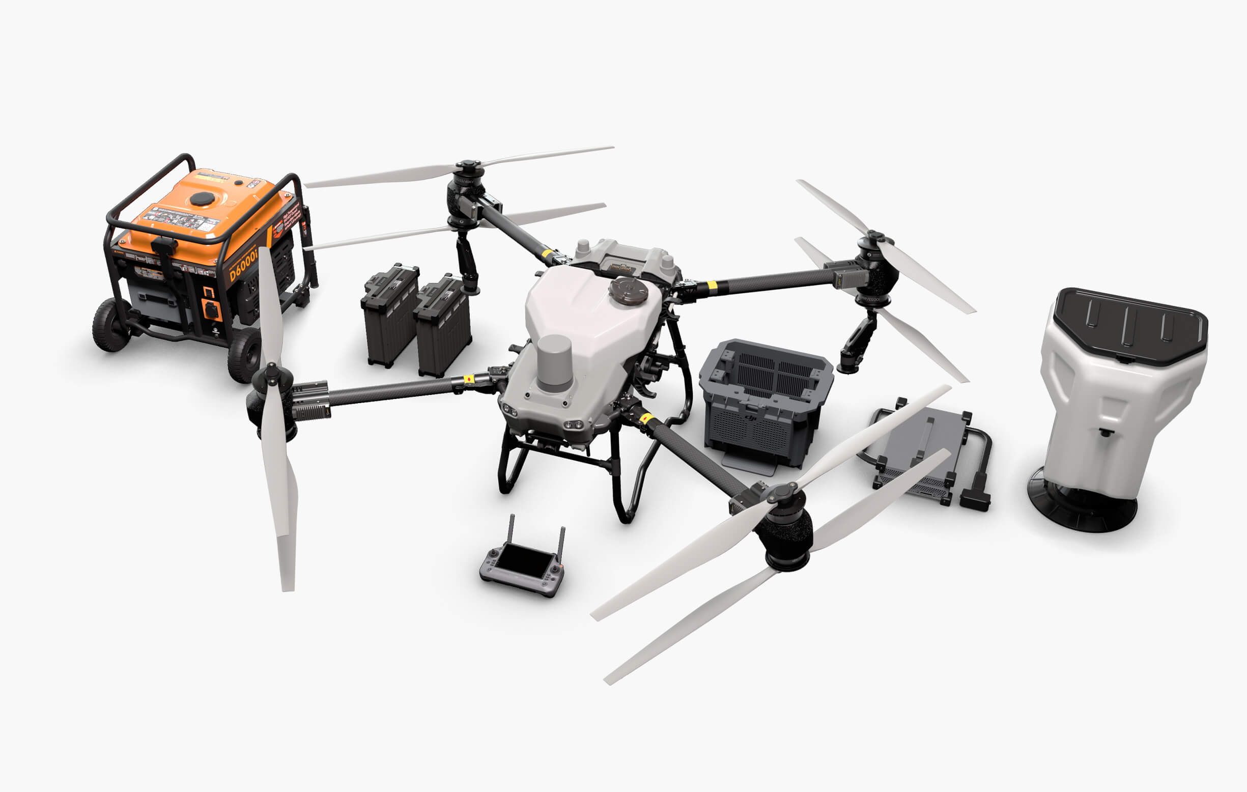
Agras T50 - DJI India

The DJI Agras T50 represents a significant advancement in agricultural drone technology, offering farmers and agricultural professionals a versatile and efficient tool to enhance productivity and sustainability in their operations.

Ratings

No Reviews Yet

Overview

The DJI Agras T50 is a state-of-the-art agricultural drone designed to enhance efficiency and precision in farming operations. Building upon DJI’s legacy in agricultural technology, the Agras T50 integrates advanced spraying and spreading systems, intelligent flight control, and robust safety features to meet the diverse needs of modern agriculture.

Key Features & Benefits

  • High Payload Capacity: The Agras T50 is equipped with a 40-liter (10.5-gallon) spray tank, allowing for extensive coverage of up to 52 acres per flight hour.
  • Efficient Spraying System: With a swath width of approximately 36 feet (11 meters) and a maximum flow rate of 6.3 gallons per minute (24 liters per minute), the drone ensures uniform and efficient application of liquids.
  • Advanced Obstacle Sensing: Equipped with multidirectional obstacle sensing, including binocular vision sensors and terrain radar, the Agras T50 can detect and navigate around obstacles, ensuring safe operations even over steep slopes.
  • Intelligent Flight Control: The drone features advanced GPS and RTK technology for precise navigation, along with autonomous flight capabilities for efficient mission planning and execution.
  • Versatile Application Modes: Beyond spraying, the Agras T50 can be equipped with a spreading system, enabling it to handle tasks such as seeding and fertilization with a spreading capacity of up to 1,500 kg per hour.

Use Cases / Applications

  • Crop Spraying: Efficient application of pesticides, herbicides, and fertilizers over large areas, reducing manual labor and ensuring uniform coverage.
  • Seeding: Capable of spreading seeds over vast fields, promoting efficient planting and reducing soil compaction compared to traditional methods.
  • Field Mapping and Surveying: Utilizes high-resolution cameras and sensors to create detailed maps for crop monitoring and analysis.
  • Precision Agriculture: Assists in site-specific crop management by providing accurate data for informed decision-making, optimizing resource usage, and improving crop yields.

Technical Specifications

Model Name
DJI Agras T50
Drone Type
Quadcopter
Release Date
April 2024
Weight
Approx. 53 kg (empty) and up to 103 kg with maximum payload
Dimensions
1958 × 1864 × 734 mm (unfolded); 1175 × 995 × 820 mm (folded)
Material
High-strength composite materials
IP Rating
IPX6K
GPS Mode
Yes
Sport Mode
Yes
Cinematic Mode
Yes
AI-based Object Recognition
Yes
Terrain Follow
Yes
Customizable Flight Paths
Yes
Failsafe Features
Yes
Battery Capacity
30 Ah per battery.
Battery Voltage
52.8 V
Battery Type
Intelligent Lithium-Ion
Charging Time
High-speed charging.
Removable Battery
Yes
Battery Life
7 minutes (fully loaded) to 15 minutes (without payload).
Charging Method
DJI C10000 intelligent charger
Remote Controller Range
Up to 2,000 meters
Transmission Frequency
Up to 2,000 meters
Video Transmission System
OcuSync
Live Video Feed Resolution
1920 × 1200 pixels
Controller Type
RM700B with a 7-inch LCD touchscreen
Mobile App Compatibility
DJI Agriculture App
Operating Temperature Range
0°C to 45°C.
Operating Altitude
Up to 30 meters
GPS Mode
Yes
Sport Mode
Yes
Cinematic Mode
Yes
Sensors & Navigation
Yes
IMU (Inertial Measurement Unit)
Yes
Barometer
Yes
Compass
Yes
Optical Flow Sensor
Yes
Altitude Hold
Yes
Precision Landing
Yes
Firmware Update Options
Via DJI Agriculture App
Operating System Compatibility
iOS and Android.
Flight Logs
Automatically recorded
Warranty Period
Provided through DJI-authorized service centers.
Extended Warranty
Typically one year (extendable).
Support Services
Provided through DJI-authorized service centers.
Lighting
Built-in LED lights
Foldability
Yes
Portable/Compact Design
Yes
Payload Capacity
40 liters for spraying; 50 liters (approx. 75 kg) for spreading

FAQs on Agras T50 - DJI India

1. What is the maximum flight altitude and speed of the DJI Agras T50?
The maximum flight altitude is 100 meters (subject to local regulations), and the maximum flight speed is 10 m
The droplet size ranges from 50 to 500 μm and can be customized or set to one of six levels: Very Coarse, Coarse, Medium, Fine, Very Fine, and Extremely Fine
These systems provide multidirectional obstacle sensing, obstacle bypassing, and steep-slope terrain following
The DJI Agras T50 can survey slopes up to 20°
Area Route surveying maps all areas and detects field boundaries and obstacles, while Boundary Route surveying maps a 20-meter wide area around the field boundary, suitable for areas without obstacles
Yes, orchard and field routes are compatible with other T series Agras drones
Yes, RTK is required for precise FPV mapping
The recommended generator specifications can be found in the user manual or by consulting with your local dealer

No Reviews Yet