
 हिंदी
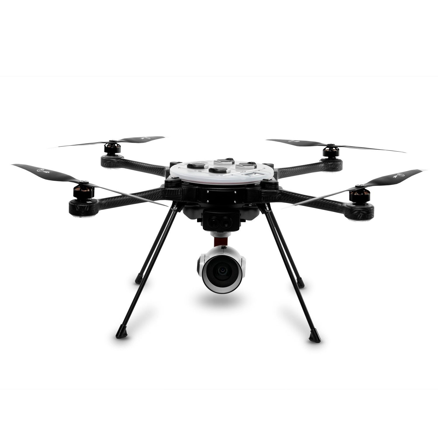
Teledyne FLIR SkyRanger R70 – Tactical Intelligence with Survey-Grade Precision
कीमत (GST सहित)
₹13 Lakh
Defence
45 मिनट
अधिकतम उड़ान समय (मिनट)
Approx. 5.4 kg
Weight (unloaded)
This drone is perfect for tactical operations, industrial inspection and precision aerial data collection. The R70 combines AI capabilities, military-grade durability and modular payload flexibility. With its cutting-edge flight system and payload versatility, it’s a good option for defence forces, public safety agencies and industrial survey teams. The total cost of this drone in India is around Rs.13,00,000
मुख्य विशेषताएं और लाभ
- Specifications:
- - High-Resolution Imaging Payloads: It supports FLIR’s proprietary imaging systems, including HD EO/IR cameras for thermal and optical data, enabling operations in both day and night conditions.
- - AI-Enhanced Autonomy: It features object detection and tracking, GPS-denied navigation, and onboard AI abilities for executing complex missions in dynamic environments.
- - Multiple Payload Capacity: The R70 can carry up to three simultaneous payloads and supports 3.5 kg, providing extensive mission customization options.
- - 45-Minute Flight Time: The R70 features hot-swappable dual batteries, offering extended flight endurance and making it perfect for surveys or long surveillance.
- - Weather-Resistant Design: Rated for IP53 weather protection, the drone can operate in rain.
उपयोग के मामले / किसे खरीदना चाहिए
- Use Cases:
- - Tactical Surveillance & Public Safety: It is used by defence agencies and police forces for reconnaissance, crowd monitoring and high-risk incident response.
- - Disaster Response & Search Operations: This drone excels in SAR missions, providing superior thermal vision for assessing damage.
- - Border Security & Perimeter Monitoring: With long flight times and safe communications, it is valuable for incessant perimeter surveillance.
- - Surveying in Challenging Terrain: Perfect for 3D mapping and terrain modelling in remote or GPS-compromised areas, with pin-point accuracy.
Physical Specifications
Weight (unloaded)
Approx. 5.4 kg
Battery & Power
अधिकतम उड़ान समय (मिनट)
45 मिनट
Flight Time / Battery Life(Mins)
45 minutes
Sensors & Navigation
कैमरा
HD 1080p (EO), with advanced IR thermal options
साझा करना :
नई टिप्पणी जोड़ें